
Stormwater sewer network inventory
You cannot manage a network effectively if you do not know it.
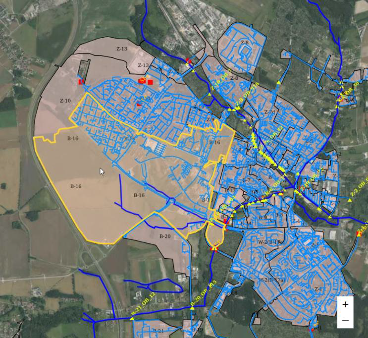
We carry out the inventory and asset registration of stormwater, combined sewer, and sanitary sewer systems, as well as storm overflows and elements of both open and closed drainage infrastructure. We collect, organise, and structure data on the network, assets, facilities, land cover, and catchment imperviousness, and then upload it into a structured GIS environment, including the GIShub platform.
Manage water and wastewater infrastructure in one place
GIShub is an infrastructure management system operating in a GIS environment, used by both large cities and smaller municipalities. The solution has been proven in practice across different types of local government units. The application is divided into two functional areas: Operations and Fees.
The Operations module enables structured collection, presentation, and processing of information on water and wastewater assets, including stormwater and sanitary sewer networks. Geospatial data includes descriptions, photographs, and archived files. The data structure, asset types, attribute sets, and scope of maintenance activities can all be configured by operators, allowing the system to be tailored to the specific needs of a given organisation.
The application records the history of changes and all reported events relating to individual assets. It also supports the organisation of field team work, both for day-to-day operations and long-term planning. The entire Operations module also enables the creation of reports and tasks assigned to specific infrastructure elements.
A sewer network inventory is often the first step before taking over the system for management. Sound planning of network upgrades, new investments, or proper catchment management requires up-to-date and well-organised data.
Discover the GIShub application
GIShub functions
- entering inventory data such as manholes, separators, pipelines, sewers, properties, tanks, and catchments as points, lines, and polygons,
- recording asset parameters and creating summaries relating to the number and type of devices, catchments, and properties,
- managing network operations, including planning and assigning tasks to service teams,
- automatic reminders for required operational activities, such as cleaning sediment traps and separators, warranty inspections of pumping stations, renewal of water law permits, or fee calculation,
- support for fieldwork using mobile devices.
GIShub advantages
- intuitive operation and fast implementation combined with user training,
- one consistent database available in a structured environment,
- reduced risk of errors and time savings thanks to reliable data, automatic calculations, and the generation of letters and declarations,
- browser-based access from multiple devices,
- no need to invest in servers or additional hardware infrastructure,
- expert support covering not only system operation, but also consultations with specialists in engineering, law, design, and GIS,
- improved cooperation with field teams, including through the use of codes for identifying assets in the field,
- the possibility of preparing an individual version of the GIShub Pro application tailored to the needs of a specific city or municipality.
GIShub training
The city gains
- up-to-date and consistent sewer system data,
- better cooperation between departments,
- faster preparation of investments,
- reduced risk of decisions being made on the basis of an incomplete picture of the sewer network.

Organise your sewer network data and prepare the city for future investments. Our company’s expert in this field is Adam.
Get in touch with us and fill in the form.


FAQ
What does a storm sewer inventory involve?
It involves collecting, organizing, and describing data on the network, structures, ditches, watercourses, outlets, and other drainage system components, and presenting them for example in a GIS database.
When should a city carry out a storm sewer inventory?
Before network modernization, GIS implementation, major investment planning, hydrodynamic modelling, or asset management work, and also when applying for funding.
Does the inventory cover only pipes, or also ditches and watercourses?
A properly prepared inventory should cover the entire drainage system, because operational problems often result from the links between the pipe network and open receivers.